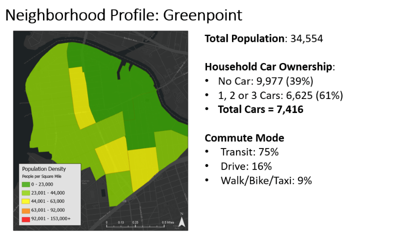
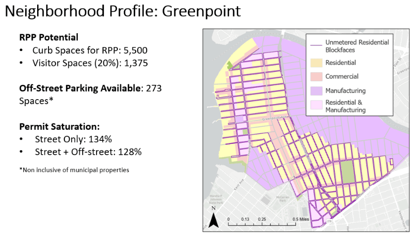
As a Parking Planner within NYC DOT’s Parking Planning & Policy Unit, in response to requests from electeds, I analyzed unmetered, residential blocks throughout NYC to estimate a space count for Residential Parking Permit potential. I used these to develop Neighborhood Parking Profiles for geographies throughout NYC, in order to understand the parking practices and needs of each. Ultimately, because the number of (registered) vehicles far exceeds the number of available spaces in each neighborhood, we could not recommend introducing a paid parking “hunting license.”
Revenue Projection
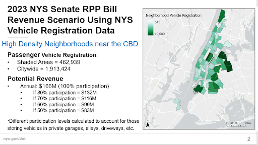
Other work on Residential Parking Permits included revenue estimation that took into account neighborhood density and vehicle registration estimates. This work was done in 2023 in response to requests from elected officials. My boss at the time told me that this question comes up every few years: here it is popping up again in 2025, this time framed as a response to congestion pricing.
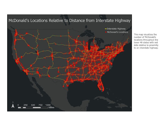
Proximity of mcdonald’s to highways
I have a longstanding interest in McDonald’s as employer & economic driver, as well as touchstone of uniformity and reach. As a transportation enthusiast, I see parallels between the proliferation of McDonald’s across the US and the birth of the Interstate Highway System. This map is part of a larger project meant to connect the two.
Extreme heat on nyc streets – heat sensor analysis & story map